Churches In Ballymoney

Derrykeigan Parish Church (1)

Churches in Ballymoney

Church of Ireland

St Patrick’s COI Ballymoney
Rev Andrew Sweeney & Rev Brian Moore Howe
The Rectory
4 Queen Street
Ballymoney
BT53 6HY
Tel: 028 2766 2149
Website: www.stpatricksballymoney.com

Killagan COI
Richard Willans
95 Hillmount Road
Cullybackey
BT42 1NZ
Tel: 028 2588 0248

Derrykeighan COI (St Colman’s)
Rev John Robert Anderson
231 Castlecat Road
Dervock
BT53 8BP
Tel: 028 2074 1241

All Saints’ COI
Loughguile
Rev Derek James
106 Mountsandel Road
Coleraine
BT53 8RJ
Tel:

Finvoy COI
Rev Andrew Sweeney, Rev Brian Moore Howe (curate)
The Rectory
4 Queen Street
Ballymoney
BT53 6HY
Tel: 028 2766 2149

St Andrew’s COI Rasharkin
Rev Andrew Sweeney, Rev Brian Moore Howe (curate)
The Rectory
4 Queen Street
Ballymoney
BT53 6HY
Tel: 028 2766 2149

Presbyterian

Ballymoney First Presbyterian
Rev Gareth John Maclean
The Manse
87 Charlotte Street
Ballymoney
BT53 6AZ
Tel: 028 2766 2292

Garryduff Presbyterian
Rev Rodney Moody
83 Garryduff Road
Ballymoney
BT53 7DF
028 2766 7497
Email: rmoody@presbyterianireland.org

Ballyweaney Presbyterian
Rev Kenneth Henderson
29 Mount Hamilton Road
Cloughmills
BT44 9NQ

Kilraughts Presbyterian
Rev Noel McClean
24 Topp Road
Ballymoney
BT53 8LT
Tel: 028 2766 7618

Bushvale Presbyterian
Rev Kenneth Crowe
Bushvale
10 Livery Road
Stranocum
BT53 8PL
Tel: 028 2074 1156

Rasharkin Presbyterian
Rev James Craig Simms
27 Moneyleck Road
Rasharkin
BT44 8QB
Tel: 028 2957 1665

Dervock Presbyterian
Rev Scott Moore
32 Carncullagh Road
Dervock, Ballymoney
BT53 8BT

Roseyards Presbyterian
Rev Mark Jones
Roseyards Manse
101 Kirk Road
Ballymoney
BT53 8HN
Tel: 028 2074 2599
http://old.roseyards.org/

Drumreagh Presbyterian
Rev Hugh W Mullan BA BD
Drumreagh Manse
99 Bann Road
Ballymoney
BT53 7NA
Tel: 028 2766 3210
Email: info@drumreagh.org
Website: www.drumreagh.org

St. James’s Presbyterian
Rev Hugh Cubitt
St James Manse
6 Coleraine Road
Ballymoney
BT53 6BP
Tel: 028 2766 3217

Dunloy Presbyterian
Rev Rodney Moody
83 Garryduff Road
Ballymoney
BT53 7DF
Tel: 028 2766 7497
Email: rmoody@presbyterianireland.org

Trinity Presbyterian
Rev D Ian J McNie
The Manse
Rodeing Foot
Ballymoney
BT53 6JJ
Tel: 028 2766 3184

Finvoy Presbyterian
Rev Robert (Roy) William Gaston
Finvoy Manse
5 Tullaghans Road
Ballymoney
BT53 7JW
Tel: 028 2957 1953

Roman Catholic

Ballymoney (Church of Our Lady & St Patrick)
Rev Francis O’Brien PP
81 Castle Street
Ballymoney
BT53 6JT
Tel: 028 2766 2003
E:office@ballymoneyparish.com
W: www.ballymoneyparish.com

Loughguile (St Patrick’s RC Church)
Rev Sean Connolly
7 Tullyview
Loughguile
BT44 9JY
Tel: 028 2564 1515

Cloughmills (Sacred Heart RC Church)
Rev Fr Liam Blayney
Parochial House
7 Culcrum Road
Cloughmills
BT44 9NH
Tel: 028 2763 8267

Magherahoney (St Mac Nissi’s RC Church)
Very Rev Canon George O’Hanlon
62 Coolkeeran Road
Armoy
Ballymoney
BT53 8XN
Tel: 028 2075 1121

Dervock (Our Lady & St John The Evangelist RC Church)
Rev Francis O’Brien PP
Canon Dominic Patrick
81 Castle Street
Ballymoney
BT53 6JT
Tel: 028 2766 2003

Plains (St Columba’s/Columban/Columbus RC Church)
Canon Malachy Murphy, Rev John J Murray
9 Gortahar Road
Rasharkin
BT44 8SB
Tel: 028 2957 1212

Dunloy (St Joseph’s RC Church)
Rev Fr Liam Blayney
14 Presbytery Lane
Dunloy
Ballymena
BT44 9DZ
Tel: 028 2765 7223

Rasharkin (St Mary’s RC Church)
Canon Malachy Murphy, Rev John J Murray
9 Gortahar Road
Rasharkin
BT44 8SB
Tel: 028 2957 1212

Reformed Presbyterian

Ballymoney Ref Presbyterian
Rev Edward McCollum
15 Millgrange
Finvoy Road
Ballymoney
BT53 7QB
Tel: 028 2764 9252

Dervock Ref Presbyterian
Rev John Hawthorne
60 Benvarden Road
Ballybogey
Ballymoney
BT53 6WN
Tel: 07845 198 328

Cloughmills Ref Presbyterian
Tel 028 2763 8901
Kilraughts Ref Presbyterian
Rev David Fallows
8 Beckett Avenue
Seacon Road
Ballymoney
BT53 6TX
Tel: 028 2766 5386

Free Presbyterian

Hebron Free Presbyterian
Rev David Park
55 Market Street
Ballymoney
BT53 6ED
Tel: 028 2766 2039

Rasharkin Free Presbyterian
Rev Kevin McLeod
29 Moneyleck Road
Rasharkin
BT44 8QB
Tel: 028 2957 1133
Cloughmills Free Presbyterian
028 2764 1971

Other Places of Worship

Ballymoney Baptist
Pastor Colin Adams
2 Parklands
Ballymoney
Co. Antrim
BT53 7QU
Tel: 028 2766 6452
Email: ballymoneypastor@gmail.com
www.ballymoneybaptistchurch.org

Ballymoney Kingdom Hall of Jehovahs Witnesses
Ballybrakes
Ballymoney
Ballymoney Church of God
Pastor EG Taylor
74 Semicock Road
Ballymoney
BT53 6PY
Tel: 028 2766 3089

Mount Carmel Revival Centre
Pastor Gordon Gillespie
Meeting in Ballymoney Orange Hall (High St)
Ballymoney Methodist
Rev Greg Alexander
33 Grange Road
Coleraine
BT52 1NG
Tel: 028 7034 3158

Registrar’s Office
Janet McCaughey
Riada House
14 Charles Street
Ballymoney
BT53 6DZ
Tel: 028 2766 0200

Elim Pentecostal
Pastor Graham Adams
5 Ballymacormick Park
Ballymoney
BT53 6QE
Tel:

The Barn Fellowship
Currysiskan House
Dr John Matthews
Currysiskan House
56 Macfin Road
Ballymoney
BT53 6QY
Tel: 028 2766 3273

Salvation Army
Captain Joan Archibald
Salvation Army Quarters 154 Mount Eden Limavady BT49 0TS
Tel: 028 7772 2613

Ballymoney Natural Environment

Ballymoney Natural Environment (1)

The Natural Environment of Ballymoney

Ballymoney Borough covers approximately 161 square miles and is predominately rural in character.

The equable climate, which the Borough enjoys, is attributable to the fact, that Ireland lies in an area of mild south-westerly winds and comes under the influence of the Gulf Stream. The average air temperature in January and February (the coldest months) is between 4C – 7C and in July and August (the warmest months) is between 15C – 18C.

The town itself is straddled to the west by the River Bann and to the north by the River Bush. Other rivers within the Borough also include the Ballymoney River, a tributary of the River Bann. Many of these rivers and their tributaries have now been designated as important salmon spawning areas due to the substrate of mainly sand and gravel. The presence of fish within these rivers is a good indication of the health of the natural environment.

Part of the Borough lies within the Antrim Coast and Glens Area of Outstanding Natural Beauty. However, a number of different environments have been identified within the Borough. A view of these environments can be obtained by clicking below.

Overall the Borough of Ballymoney contains a rich and diverse landscape of great natural beauty and wildlife interest which can be enjoyed by residents and visitors alike.

Lower Bann Valley

The Lower Bann Valley, located in the very southern part of the Borough, extends from Ballymoney to Castledawson. Ecological features identified in this area include peat bogs and wet woodlands comprising of birch, willow and alder. However other features of mixed woodland and conifer plantations have been identified. Dry point sites dominate the locality of settlements, however linear patterns have also been identified.

Lower Bann Floodplain

The Lower Bann Floodplain refers to the lower course of the River Bann. It is predominantly flat being drained by a number of tributaries and smaller streams such as the Macosquin River, Aghadowey River, Agivey River and the Ballymoney River. Like the Bann Valley, pockets of wet woodland have been identified. Settlement pattern can be identified as being dispersed.

The Long Mountain Ridge

The Long Mountain Ridge is along ridge of land that runs from Ballymoney in the north to Randalstown in the south. It was created by the erosion of weaker bands of basalt located on either side of the feature. Due to this action, Long Mountain now forms quite a unique feature in comparison to the surrounding landscape. The land is quite fertile due to the weathering of Antrim Lavas.

A variation in slope, especially on the sides of the feature, greatly influences the size of field. However on top of the feature where the land is much flatter, field size is much bigger. There also is a mixture of hedges, shelterbelts, moorland scrub and Craigs Wood Conifer Plantation as well as the presence of archaeological features.

Cullybackey and Cloughmills Drumlins

The Borough also contains the Cullybackey and Cloughmills Drumlins. This area is located east of Long Mountain.

Drumlins are hills with characteristic steep sides which, when you pass its summit, becomes more gentle. There has been considerable debate about the formation of these drumlins but what seems to be the most commonly accepted argument is that they formed from glaciers that became laden with eroded material. When the glacier became overladen, this slowed down its progress and as a result material or till was deposited. Apart from the deposition of material, the sheer presence of glaciers may have helped redefine the shape of the landscape. The valleys between these drumlins, all be it quite small, are poorly drained, often producing quite a marshy area with distinct rush vegetation. When looking at an Ordnance Survey map of the area, it is clear that these hills or drumlins are a common sight.

The area also contains quite a few archaeological remains including raths and mottes but also contains the remains of our industrial heritage of yesteryear in the form of Red Brick Mills and their chimneys along the River Main. The patterns of roads in this area is also reflected in the presence of these drumlins because they have to wind their way around these features.

The Moyle Moorlands and Forests

The Moyle Moorlands and Forests comprise part of the Antrim Coast and Glens Area of Outstanding Natural Beauty. This designation is a major indication of the sensitivity and environmental importance of this area. The area is also rich in archaeology containing features such as chambered graves, standing stones and old-field patterns. Due to the openness and fragility of this upland landscape, it will be very sensitive to change.

Garry Bog

The Borough also contains many areas of ecological importance mainly the Garry Bog, a raised bog, located to the north of Ballymoney town and to the west of the River Bush. Unfortunately due to the pressures of agriculture and peat extraction, many of our lowland raised bogs are disappearing. In fact in Northern Ireland, we only have approximately 10% of our raised bogs left – (for further information click on www.ipcc.ie).

Peat bogs contain some very unique plants and animals ranging from insect eating plants such as the Sundew plant to smooth newts, which are specially protected. In fact Garry Bog was found to have a rare species of moss called Sphagnum pulchrum. Peat bogs are also important breeding grounds for Damsel and Dragonflies and are an important habitat for Irish Hares and Curlews – two distinct species whose numbers have declined to dangerously low levels. However the Environment and Heritage Service have recently developed Species Action Plans to help preserve existing numbers of both species – (for further information click on www.ehsni.gov.uk)

Garry Bog has been identified as an area of ecological importance by being designated as a National Nature Reserve (NNR), Ramsar Site, Special Area of Conservation (SAC) and as an Area of Special Scientific Interest (ASSI). These various designations again reflect the environmental importance and sensitive nature of this area. Other ASSi’s, SAC’s and NNR’s located within the Borough include Caldanagh Bog, Dunloy Bog and Breen Wood. Important animal species have also been identified such as the Hen Harrier, Badger, Otter, Atlantic Salmon, Kingfisher, Irish Hare, Lapwing and various species of bat, many of which are protected by law, principally under the European Habitats Directive and 1985 (Northern Ireland) Wildlife Order.

Agriculture

Agriculture is very important to the area where some 800 farms exist. The land has therefore been intensively farmed so a lot of biodiversity (i.e. the variety of life found on earth from microbes to great whales) no doubt has been lost. However, according to the Agricultural Land Classification most of the agricultural land within the Borough has been given a Grade 2 status which indicates a very good quality soil. The soil is well drained, being brown in colour, having formed on basaltic till. Grade 2 land is in fact very valuable for farming and surprisingly a very small percentage of this land exists in our province.

Some of the hedges, which are not intensively managed, that surround many of the farmsteads are quite species rich in terms of flora and fauna. Apart from hawthorn and the occasional ash tree dominating these hedges, other flora present includes bramble, dog rose, lesser celandine and common dog violet. Other more mature trees like Scots Pine, Beech and Sycamore have also been identified in the vicinity of farmyards that are important for nesting birds. Such a resource is vital for providing a source of food for birds, small mammals and invertebrates. The presence of hedges also acts as a wildlife corridor allowing animals to freely move between semi-natural areas.

Two such agricultural areas have been identified within the Borough area:

Coleraine Farmland

The Coleraine Farmland contains most of the spectacular sites of the North Coast. It contains a rugged coastline made up of headlands and bays where the weaker basalts of the Antrim Plateau have been eroded by the onslaught of the Atlantic Ocean. The lower reaches of the River Bann flow through this area. In fact the estuarine habitat that occurs at the point where the River Bann meets the Atlantic Ocean, is a vitally important habitat for sustaining populations of visiting winter waterfowl and waders. The area also contains the famous Portstewart Strand (ASSI/ candidate SAC), which is managed by the National Trust. The vast majority of farmsteads in this area are relatively small despite the fact that the landscape is quite open. Mature beech and conifer plantations have also been identified in this area, especially along the River Bann.

Dervock Farmland

The Dervock Farmland lies just north of Ballymoney Town. This area has been identified as being a mixture of natural habitats ranging from broadleaved woodland to areas of raised bog, riverine habitats and conifer forests. Many of the farmsteads located in this area are still in keeping with the old traditional style having white painted stone farmsteads with red roofs and round stone gateposts.

Cultural & Historical Societies of Ballymoney

Cultural & Historical Society

Cloughmills Cultural & Historical Society

Edgar Aitcheson

22 Strand Park, Cloughmills, Ballymena BT44 9LL

028 2763 8437

Meeting at Cloughmills Memorial Orange Hall

Last Thursday of each month at 8:00 pm

Dance

Ballymoney Irish Dancing Festival

Joan McClean

9 Mill Cottage Way, Stranocum BT53 8AX

028 207 42960

Irish Dancing Competition

Last week in April each year.

Comhaltas Ceoltoin Eireann

The Secretary

38 Bridge Road, Dunloy, BT44 9AN

028 2765 7048

Traditional music classes, workshops and session

Weekly during term time.

JML School of Irish Dancing

Julianna McLester

5 Heatherlea Place, Ballymoney BT53 7BH

028 2766 6641

Irish Dancing

Meeting at Castle Street Community Centre, Ballymoney

Every Monday, Tuesday & Saturday

Drama

Ballymoney Literary & Debating Society

Barbara J Cooke

“Dunlis” 10 Seaport Avenue, Portbalintrae BT57 8SB, Tel: 028 2073 2708

Three Act Plays, Summer Theatre, One Act Plays, Theatre Outings and Play Readings

Meeting at the Magherabuoy House Hotel, Portrush

First Monday of the month.

Barazina Drama Club (Speech, Drama & Music Theatre)

p1-p3  2.30-3.30 Ballymoney Parish Hall

p.3-p.6 3.30-4.30 Ballymoney Parish Hall

EVERY THURSDAY during term time

Contact: Denise Rosborough

Barazina Performing Arts

Tel:07545 244 482

Email: denise@barazina.org.uk

Language & Literature

Ballymoney Creative Writers

Anne McCusker

32 Lisheegan Lane, Ballymoney BT53 7JZ

028 2766 5804

Writing short stories and poetry. Occasional public readings and social evenings

Meeting at the Joey Dunlop Leisure Centre

Tuesday 7:30pm – 9:30pm

Conaadh Na Gaeilge C.A.M.D

  An Rúnaí

38 Br. An Droichid, Dún Lathaí BT44 9AN

028 2765 7048

Irish Language Classes

Tuesdays 7:30pm – 9:00pm

Music

Ballymoney & District Male Voice Choir

Dr John Johnston

6 Tullaghgore Road

Ballymoney, BT53 6QF

028 2766 3512

Email: j.e.johnston@fsmail.net

Performing at concerts & church praise services

Meeting at Dalriada School

Mondays 7:30 pm September – March

Barazina Youth Choir

High-energy choir for 7-14-year-olds

Singing songs from Disney, Broadway and Gospel

EVERY TUESDAY evening  during term time 5.45-6.45 pm

Social Centre – Edward Street

Contact: Denise Rosborough

Tel: 07545 244 482

Email: denise@barazina.org.uk

Comhaltas Ceoltoin Eireann

The Secretary

38 Bridge Road, Dunloy, BT44 9AN

028 2765 7048

Traditional music classes, workshops and session

Weekly during term time.

Comhaltas Rasharkin

Jeannie McGrath

25 Gortahar Road, Rasharkin, BT44 8SB

028 2957 1310

Traditional music classes for all ages.

Meeting at Rasharkin Primary School

Tuesday 7:00pm – 8:30pm

Dunaghy Accordion Band

Jim Chestnutt

3 Donegore Drive, Antrim, BT41 1DT

028 9446 6754

Meeting at Dunaghy Accordion Band Hall

Monday 8:00pm – 9:30pm

Dunaghy Flute Band

David McAuley

26 Parklands, Ballymoney, BT53 7QU

077 3060 9282

The tuition of fluting, drumming and drill practice.

Meeting at Donaghy Orange Hall

Wednesday 7:00pm – 9:00pm

Dunloy Accordion Orchestra

Mark McIntyre

17 Charlotte Street, Ballymoney, BT53 6AY

028 2766 3587

Attending concerts, contests and parades.

Meeting at Dunloy Orange Hall

Twice weekly 8:00pm – 10:00pm

Girona Orchestra

Stacey Graham

35 Apollo Avenue Portrush, BT56 8HH

028 7082 9593

Concerts, competitions and other public events.

Meeting at Trinity Presbyterian Church Hall

Thursdays during term time.

Riada Concert Group

Roberta Murray

7 Grange Drive. Ballymoney BT53 7BW

028 2766 3905

Teaching accordion, keyboard and drumming skills. Giving public performances.

Meeting at St James Church Hall

Saturday 6:30pm – 8:00pm

Route Singers

Noel Linton

9 Mill Cottages, Portstewart BT55 7GB

028 7083 4159

Choral Singing.

Meeting at Dalriada School

Thursday at 7:30 pm from September – April

Vow Accordion Band

Julie Ann Taggart

20 Bravellen Road, Ballymoney BT53 7DS

028 2766 3319

Teach drum and accordion. Annual Carol Service

Meeting at Vow Orange Hall

Every Wednesday 8:00pm – 10:00pm

Barazina Youth Choir

4 Esdale Terrace

Green door

Balnamore

BT53 7QH

Visual Arts

Ballymoney Amateur Photographic Club

Zilah McCaughan

43 Kilmoyle Road, Ballymoney BT53 6NR

028 2074 1233

Photographic tuition and competitions.

Meeting at Ballymoney Town Hall

Second and fourth Monday each month 8:00pm -10:00pm

Dunloy Art Club

Sharon Lerwill

1 The Meadows, Ballymoney BT53 6AX

028 2766 3587

Art Classes.

Meeting at Conihaltas Centre Dunloy

Weekly

Loughguile Art Club

Rose Henry

10 Gruig Lane, Cloughmills BT44 9JD

028 2763 8608

Painting classes for all ages.

Meeting at The Millenium Centre, Loughguile

Mondays 7:30pm – 9:30pm

Adapt NI

ADAPT is the only voluntary organisation in Northern Ireland solely committed to “Building Equality and Inclusion through Accessibility”.

Web: www.adaptni.org

Carrick a Rede Ropebridge

Carrick A Rede Rope Bridge

Located around 16 miles north of the Ballymoney, along the causeway coast, close to Ballintoy in Northern Ireland, Carrick a Rede Rope Bridge is a suspension bridge originally made from rope that links Carrick Island to the mainland.

This site is on the world-famous Causeway Coast Route County Antrim, Northern Ireland and is maintained and owned by the conservation charity The National Trust. Nowadays, the bridge is open as a tourist attraction, with nearly half a million people crossing the rope bridge in 2019. The rope bridge has remained closed since the pandemic of 2020, with it hoping to be open again in summer 2022.

To enjoy an exciting clifftop experience visit the rope bridge to Carrick, a Rede island on the Causeway Coast. This 20-metre vast and 30-metre deep chasm above the Atlantic Ocean is crossed by the rope bridge salmon fishermen initially built. Individuals brave enough to walk across the bridge to the rocky island are rewarded with amazing views.

History

Old and New Carrick A Rede Ropebridge (1)
The Old and New Rope Bridge to Carric a rede

The name Carrick-a-rede means ‘rock in the road’, and it is believed the salmon fishermen in the area have been building the bridges to the island for more than 350 years. Over the years, the bridge has had many forms. It had significant gaps between the slats and only one handrail in the 1970s.

In 2000, local climbers built a version of the bridge tested to hold ten tonnes. In 2004 a new design was implemented, offering fishermen and visitors a safer passage to the island. The current wire rope bridge with the Douglas fir walkway was built early in 2008 by Belfast’s Heyn Construction and was created for more than £16,000. Although there is no record of anyone falling off the bridge, there have been many cases where visitors could not walk back to the mainland across the bridge and were transported off the island by boat.

Fishing

The island is no longer used by fishermen during the salmon season from June until September, as there are very few salmon left. About 300 fish were caught daily in the 1960s, but in 2002, only 300 were caught during the whole season. The salmon come back every year to spawn in the River Bush, near Bushmills, and the River Bann at Portstewart.

Features

The area boasts exceptional natural beauty with amazing views of Scotland and Rathlin Island. The surrounding area has been declared an Area of Special Scientific Interest, with unique fauna, flora, and geology. Huge caves are visible underneath, and these once served as shelter during stormy weather and as homes for boat builders.

Legend and Life

A car park at Larrybane Head’s base, which once had at its peninsula a fort for more than 1,000 years old. It has, however, been quarried away over the years, and only a stark quarry face, filled with fossils and flint, is left. There are big caves under the quarry; one of these was once a boat builder’s yard for a while, while others were used for winter shelter. The walk along the cliff’s top is exhilarating, even without the excitement of the bridge at the end.

The sea below turns every shade of blue and green in summer, while several Mediterranean lagoons make the walk to the bridge seem so much shorter. The bridge was originally built by fishermen working at a salmon fishing station during the summer. Their whitewashed cottage, complete with a wooden stairway to the path and its winch, still nestles in the only shelter on the island.

The bridge is one of the most amazing experiences on Northern Ireland’s causeway coast.

Every single step seems to move the bridge slightly, even on the calmest day, and its 20 metres length seems like it belongs in an adventure movie. Although the bridge was initially built with rope and only had a single handrail, the fishermen did an excellent job, and nobody was ever injured crossing the bridge.

On the modern bridge, ropes are only used for the netting beside the bridge, the lashings that hold the Douglas fir boards in place and the latticework sides. The bridge’s strength comes from the upper steel handrails that carry 10 tons.

Nearly 500,000 visitors come to the bridge every year.

The terror the bridge holds for many lies in the thought that a mere one-inch thick board stands between you and the waves and rocks below, 30 metres down. Once you have made it safely to the island, it is an experience like no other. The island has a unique, undisturbed and isolated quality, even though the same fantastic views over the Atlantic ocean of the Scottish Isles and Rathlin can be enjoyed from many other places on the north coast.

Although the rocks are the typical mix of limestone and basalt commonly found in this area, the basalt takes on its unique forms. Some of it is smooth like it’s been made from plasticine, while other pieces stand in tall, precariously crumbling columns.

The permanent residents of nesting razorbills, guillemots and fulmars are worth seeing.

Geology

Carrick a rede island, is one of the best examples of a volcanic plug in Ireland and the United Kingdom. Erosion by the Sea of Moyle/Irish Sea has exposed this old volcano’s neck.

The violence of molten rock punched through the soft limestone 60 million years ago can be observed via geological evidence such as Explosion breccias, Tuff, grey volcanic ash, and explosion bobs in the layers of the Island’s rock and its surroundings.

The characteristic Ulster Chalk, topped by basalt cliffs, can be found along the North Antrim coast, which forms much of the Antrim plateau. The ancient volcanic pipe has deposited dolerite, a rock more robust than basalt, at Carrickarede, which erodes much more slowly. To the south and behind the dolerite, the vent has been filled with pyroclastic rocks that deteriorate much easier to form a coarse tuff agglomerate. This small island was the eventual product of the softer rock behind and the hard rock out front that were eroded by the waves over time.

The island has big caves that are most visible during low tide. It is believed that the caves originally provided shelter for fishing vessels during stormy weather and were also used as homes for boat builders.

The ocean around the area has a natural blue colour that sometimes turns green, making the area very interesting. Unique fauna and flora cover the island, and many bird colonies play a crucial role in the area’s ecology. Razorbills, for example, live on the island and only come back to nest and mate. The island’s cliffs are covered by thrifts and birdsfoot trefoils, giving the island a paradise-like feel.

Getting To Carrick A Rede

There are various routes that can be used to get to the Carrick a rede rope bridge. The bridge is opened at 9:30 am and normally closes at 6:00 pm, although ticket sales stop at 5:15 pm. The closing time is, however, sometimes extended due to heavy tourist traffic. In the summer, the closing time is set at 7:00 pm, while the winter closing time can be as early as 3:00 pm. This can be due to a lack of tourists wanting to go on the bridge or severe weather conditions.

Carrick a rede is located around 20 minutes (15 miles) from Portrush, 10 minutes (6 miles) from Ballycastle and an hour (60 miles) from Belfast.

Dunluce Castle

dunluce_castle_shutterstock_1817921333 (1)

Dunluce Castle

Found in Northern Ireland towards the Giants Causeway along the Antrim Coast, Dunluce Castle is nestled east of Portrush on the sheer cliffs of the Causeway Coastal Route. It was built between 1400 and 1600 and was one of several Irish castles on the Coast. Dunluce Castle offers a unique insight into the past of Northern Ireland. You’ll be able to descend an ancient stairway outside the castle grounds to visit the cave beneath Dunluce or simply meander among the castle’s ruins.

Dunluce Castle Bears Witness to the history of Northern Ireland

A visit to the North Coast will simply not be complete without stopping at Dunluce Castle! Tucked away on the cliffs to the west of the Giant’s Causeway, Dunluce offers unique insights into what life was like in Northern Ireland many years ago.

An amazing experience for adults and children, historical secrets are waiting to be re-discovered hidden throughout the castle. A guide will accompany you once you’ve entered the grounds and help you explore Dunluce’s unique history. The Dunluce welcome centre also offers an excellent multi-media presentation that is worthwhile watching.

Visit Dunluce Castle With The Kids

Although Dunluce Castle is safe for children to explore, we wouldn’t recommend letting the smaller ones out of your sight. This is, after all ruins perched on a cliffside! Although the alleys, passages, and lanes are cobbled from the drawbridge, disabled access is available throughout the castle’s site. The walk is also easy for young children and elders alike, as there are many places along the cobbled streets they can sit and rest if required.

Although we have been to Dunluce Castle many times, we always find something new to appreciate or discover about this amazing past structure.

Narnian Inspiration?

It is rumoured that Dunluce Castle was a big part of CS Lewis’ inspiration for the “Cair Paravel” in his Chronicles of Narnia series. Children familiar with the series love exploring the castle’s mysteries.

Apart from engaging in the legends of Dunluce, children also love exploring this amazing artefact’s ruins, rooms, and turrets. The views from the dramatic coastal cliffs are also spectacular, which already makes the visit worthwhile.

Dunluce Ownership

Over the years, several family ‘clans’ ruled Dunluce, including the MacDonnells, the MacQuillans, and Scottish settlers living in the small town. It was the second Earl of Ulster, Richard Od de Burgh, who built the first Dunluce castle.

Building Dunluce Castle

Richard Og de Burgh was also known as “The Red Earl”. He was one of the more powerful Irish nobles in the 1400s, and he chose this location along the Causeway Coast to build a castle. As the highest ranked Earl in Ireland, Richard was famous in his own right, while Elizabeth, his daughter, became the second wife of Scotland’s King Robert the Bruce.

“The Red Earl” was the originator of Dunluce Castle and the town’s long and tumultuous history. You’ll be able to learn a lot more about Dunluce Castle’s history from the well-documented information pack handed out by the Dunluce visitor centre when you arrive.

In 2011, a major excavation of the town of Dunluce, also known as the “lost town,” provided a wealth of new information about society’s rise and fall around Dunluce.

Historical Significance

Dunluce Castle has officially been declared a nationally important archaeological site. This is aimed at protecting the ruins from any unauthorized changes.

As Dunluce is the only “scheduled monument” in North Antrim Coast, an opportunity to visit this well-preserved site is well worth the trip.

The entire family will enjoy the majesty of this magnificent structure that is so well preserved. The grounds are in excellent condition and maintained regularly, the walking areas are well paved, and although these are cobbled, they are relatively even. The entire site is clean, and well looked after.

The castle is not only intact, but you can also descend a stairway located outside the castle grounds to visit the cave beneath Dunluce.

Is Dunluce Haunted?

One of the children in the MacQuillan family in 1534 claimed that they had seen a woman in a white dress as she stood at the cliff’s edge and looked out over the sea one stormy night. According to his story, she then faded away into the wind. As nobody believed him, he convinced his oldest sibling to accompany him the next night to watch out for the ghost, but to his disappointment, it did not appear.

Much later, in the early 1550s, many more people started claiming to have seen a woman in a white dress walking at sunset on the shore below Castle Dunluce. By then in his 30s, the McQuillan boy finally walked down to the shore one evening and tried to talk to the ghost. The appearances stopped after that incident. There have been no further reports of the woman being seen again.

Mussenden Temple & Downhill

Downhill Demesne Mussenden temple and Downhill House from the air

Mussenden Temple

You can find a round stone building near Castlerock, within the grounds of Downhill Demesne, Mussenden Temple. This iconic building is located right on the brink of the impressive cliffs overlooking the Downhill Strand.

The Temple may be visited by the public during the day all year round and is operated by the National Trust. The outdoor space at Mussenden Temple is also open for local visitors. Mussenden Temple was initially built in 1785 and served as a summer library, with its walls lined with full bookcases. The National Trust had to undertake cliff stabilisation work in 1977 to prevent losing this spectacular building.

Behold From The Shore

Mussenden Temple is situated at one of the most incredible coastal locations in the world, on the northwestern coast of Northern Ireland. It clings to the cliff edge, which drops away to the beach and rocks far below.

Originally built as a library, Mussenden Temple has an inscription on the outside that reads,

Suave, mari magno turbantibus aequora ventis e terra magnum alterius spectare laborem.”

This translates to “Tis pleasant, safely to behold from the shore, the troubled sailor, and hear the tempests roar.”

To have both a good book and leisure time is a magical experience, but Earl Bishop went one better and created a magnificent building with an outstanding view for all his books.

Sky, Sea, and Coast

Mussenden Temple lies within Downhill Demense’s grounds and is operated by the National Trust. Visiting this special place is an experience not to be missed, and it is one of the genuinely magical on earth. The sky, the Sea, and the coast, this stunning building serves as a great pedestal from which you can enjoy them all.

Mussenden Temple Location

The Mussenden Temple is north of Downhill Demense, the manor house, and can be reached via a pathway leading from the castle exit toward the Sea.

The walk from Downhill to the library is pleasant, providing no strong winds, and it meanders through green grass while offering spectacular ocean views.

The Temple is open to the public at specific times, and intimate musical performances and concerts are presented annually.

Visit the National Trust for more information.

Earl Bishop Walking To The Library

It is easy to imagine the Earl strolling from the house towards the seaside cliff face with one of his many books in hand. The pleasant walk is rejuvenating to the cliffs overlooking Downhill Strand. Nowadays, visitors are fortunate to have Al’s Coffee Hut for a takeaway coffee or tea.

There are several walking trails around Mussenden Temple and Downhill Demesne. Close to the dovecote, you can find a magical walled garden, which is well worth exploring. All paths at the exit of the walled garden ultimately lead back to the Downhill House ruins.

Downhill Beach

To the left of Mussenden Temple lies Downhill Beach, facing west, and the views in that direction over the North Atlantic are simply incredible.

On a clear day, the shores of Donegal, the mouth of the Foyle and Magilligan Point, can be seen to the west, while Castlerock and Castlerock Beach’s towns lie to the east.

The beach ends at Magilligan Point, some 7 miles from Downhill.

Inspiration for The Narnian Series?

It is believed that CS Lewis was in part inspired by his writing by Downhill. The Demense was a sprawling estate in its day but now lies in ruin. All that is left of a Bishop’s home are the large stone walls, currently serving as a monument to an Earl from long ago.

CS Lewis regularly holidayed in Castlerock, a small town within walking distance of Downhill.

If you have visited this area and have read the Narnia series, you will no doubt have been struck by the similarities between Lewis’ stone-table ruins and the surrounds of the Mussenden Temple.

Locations Close By on The North Coast:

Downhill Demesne Mussenden Temple and Downhill House

Sometimes called Downhill House, Downhill Demesne is a remarkable mansion built by the eccentric Earl Bishop in the 18th century. It is set within beautiful open grounds and is the perfect spot for a day outing. The sheltered gardens at Hezlett House make a magical setting for a picnic while visiting Downhill Demesne. Parking is at Lion’s Gate car park.

Castlerock

Known as the Western Gateway of the Causeway Coast on the north coast of Northern Ireland, Castlerock is a famous seaside village located 5 miles west of Coleraine. It blends the past and the present perfect. Although less than fifteen hundred people live in the town, it attracts many more local visitors who want to stay local, as well as those from farther afield due to a variety of places to visit nearby, a naturally beautiful landscape, and excellent amenities. East Castlerock Beach is very popular for surfing and swimming.

Hezlett House

When driving to Castlerock via the main A2 turnoff, the 17th-century Hazlett House can be seen one mile south of the town on the corner of Sea Road.

This is an amazing example of a well-preserved Thatched Cottage. At Halloween each year, the ancient cottage is transformed into a scary haunted house.

Hazlett House is now owned by The National Trust, and visitors can step back in time as they explore the well-manicured cottage grounds and the inside to experience what life was like in the late 1600s. This is one of Northern Ireland’s oldest buildings, and hot drinks and snacks are offered at the reception area. 

The Dark Hedges

Dark Hedges Visit Ballymoney Northern Ireland

0

Guide To The Dark Hedges

The Guide to the Dark Hedges

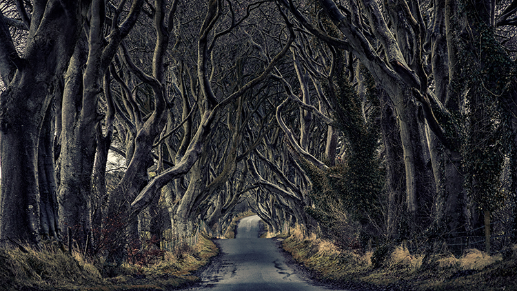
The Dark Hedges, one of the most popular attractions in Northern Ireland, is a beautiful row of beach trees made famous by appearances in TV shows and films such as Game of Thrones. The Dark Hedges is a favourite stop on the Causeway Coastal Route road trip, running along Ireland’s North Coast from Belfast to Derry.

In this guide, we’re going to look at everything you need to know to get the most out of your visit to the Dark Hedges, including how to get there, where to park, how to avoid the crowds, and places to stay nearby.

What are the Dark Hedges?

The Dark Hedges is an avenue of mature beech trees,  planted around 1775 by James Stuart to frame the avenue leading to his home, Gracehill House. The trees, originally around 150, line both sides of Bregagh Road, forming an imposing tunnel along the roadway.

Today, the Dark Hedges still lead up to the current gates of Gracehill House.

Gracehill House is privately owned and operates as a bar & restaurant, wedding venue, and golf course. So you can visit the estate for a drink, meal, or play a round of golf while on your trip.

Game of Thrones (GoT) fans should visit Gracehill House during opening hours to see one of the 10 GoT-themed doors based on the 6th season of the show. The door at Gracehill was carved from one of the Dark Hedges trees that fell during Storm Gertrude in 2016.

The 250-year-old trees are very atmospheric. The stunning organic tunnel of tree limbs crisscrossing the road, made famous by HBO’s Game of Thrones, draws thousands of visitors worldwide.  Sadly, many of the trees have been lost due to storms and damage (part of the road was closed to traffic in 2017 was due to the damage caused), with just over 90 of the original 150 trees still standing.

Why are they Called the Dark Hedges?

From our research, it seems unclear when or why the name of the Dark Hedges was given; however, there are two likely explanations. First, the most obvious answer is that the massive trees block most of the light, resulting in a “dark” tunnel that looks like a hedge.

The other explanation is a bit eerie. Local legend has it that the hedges are haunted by a ghost known as the Grey Lady, who haunts the trees, flitting from one to another before always disappearing at the last beech tree. As the story goes, she is joined by spirits from a nearby ancient graveyard on Halloween!

Whatever the reason, we are sure you will agree it’s a very appropriate name for this stunning location!

Legend has it that a Grey Lady Walks the Dark Hedges

Where is the Dark Hedges Located?

The Dark Hedges is found in County Antrim in Northern Ireland between the villages of Armoy and Stranocum, around a 10-minute drive from Ballymoney. They can be located on Bregagh Road (about half a mile long), between Ballykenver road to the south and Ballinlea Road to the north, near The Hedges Hotel

The Hedges are around 50 miles, or an hour’s drive, northwest of Belfast and 150 miles, or approximately 3 hours, drive from Dublin.

How to Get to the Dark Hedges?

There are many ways to get to the Dark Hedges:  you can drive yourself, take a tour, or take public transport.

Driving to the Dark Hedges

This is probably the quickest way to get there, giving you flexibility in terms of how long you spend here and where else you can go It’s about a 20-minute drive from Portrush or if you are coming from Belfast, about 1 hour. Free car parking is a short walk from the Hedges, as the road is now closed to traffic (see parking section below).

You can still see evidence of root damage and many car tracks in the mud, which makes us sad (and a little angry).

Since its closure, high fines (up to £1,000) may be given to motorists attempting to drive or park along the Dark Hedges.

If you are driving up from Belfast or Dublin, we recommend that you come along the Causeway Coastal Route, along the A2, as it has some of the most breathtaking driving in the world.

Where to Park for the Dark Hedges?

This is not the view you came to see

There is a large free visitor car park beside The Hedges Hotel, just off Ballinlea Road. This is an easy two-minute walk from the north end of the Dark Hedges, along with the marked path.

Address of Parking:

139A Ballinlea Road, Stranocum, Ballymoney BT53 8PX

GPS Coordinates of Parking:  

55°08’17.9″N 6°23’01.4″W

Please don’t try to park at the entrance to Bregagh Road, as not only can this damage the tree roots that are close to the surface, but more importantly, it will also ruin everyone’s photos.

Dark Hedges by Day Tour

If you don’t have a car or maybe want to just sit back and let someone else do the driving, many guided day tour options include a stop at the Dark Hedges.

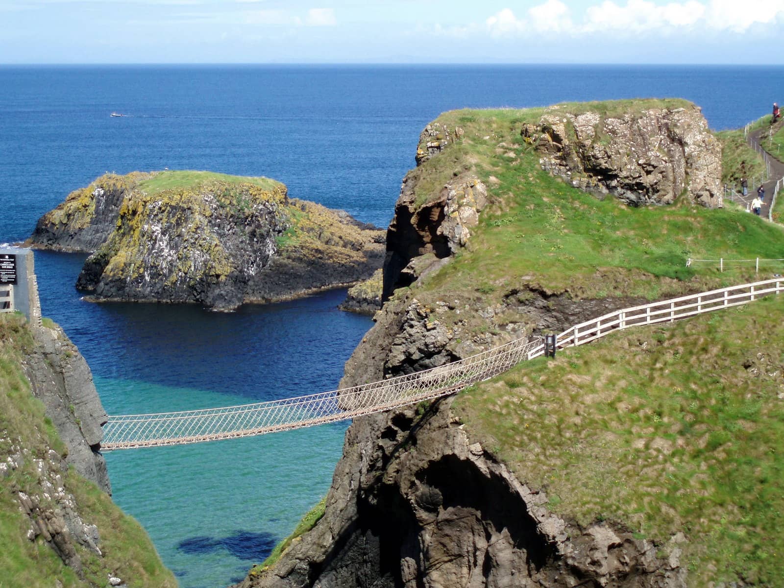
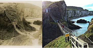
Most tours stop at many other amazing places near Ballymoney and along the Causeway Coastal Route, such as the Giant’s Causeway, Carrick-a-rede Rope bridge and possibly those who like a tiple the Bushmills distillery.

You will find many tours that leave from both Belfast and Dublin, including tours offered through GetYourGuide (see 20+ options here) and  Viator (you can explore 40+ tour options here).

However, we have listed some local companies in the Tours Section below.

Giant Tours Ieland

Dark Hedges by Public Transport

While it is often decried by those who live here ( I’ve never been anywhere that this isn’t true), it is also possible to get to the Dark Hedges by public transport from Portrush, Belfast and Dublin.  

Although there is no bus stop or train station at the Dark Hedges, some are within walking distance.

Translink has a journey planner that is very good and can be found here

Dark Hedges By Public Bus

From Ballymoney, depending on connections, it’s about half an hour to get to the Dark Hedges. This involves getting a bus from the Town hall, getting the Ballycastle Bus (at the time of writing the 178 Bus), and getting off at Clintyfinnan. Clintyfinnan is a small hamlet only a short from the southern end of the walk from the Hedges.

From Belfast, it’s around 2 to 2.5 hours by bus to get to the Dark Hedges. There are a few ways to do this, but one way is to take the Translink Goldline 218 bus (or train and the bus and train station cohabit) from Belfast to Coleraine and then change to the 171 (Ballycastle) bus at Coleraine as above.

If you are stuck, just ask for the stop nearest the Dark Hedges / The Hedges Hotel at the station or on the bus, as the Bus drivers are generally accommodating on this route.

Dark Hedges By Train

Getting to the Dark Hedges by train, you have two options. The first is as above. You can take the train from Belfast to Ballymoney, which takes about an hour. From there, you will need to make a 10-minute taxi ride from the Ballymoney train station to reach the Dark Hedges, or take a short walk into the town and get the 178 (Ballycastle) bus and get off at Clintyfinnan stop (you’ll also see the Dark Hedges Experience at this stop.

Dark Hedges Map

This map is a quick overview of the Dark Hedges, including where the car park and the main stretch of the road are. For reference, the red line is around half a mile long.

The Red Line Shows the Length of the Dark Hedges

How much does it cost?

The Dark Hedges is currently free to park and visit. See parking information above for where you can legally park for free.

The site was not developed as a tourist destination and, until before it became famous through Game Of Thrones, it was just a short stretch of a typical country public road. There is free parking next to The Hedges Hotel and a nice path leading to the Dark Hedges.

Causeway Council has a small tourist information hut at the beginning of the path with local visitor information near the parking area.

Be warned. There are no tourist facilities at the actual Dark Hedges (water, toilets, etc.). However, the two restaurants within a few minutes of the Dark Hedges are excellent.

The Scullery Bar & Restaurant at The Hedges Hotel serves breakfast, lunch, and dinner and is open to hotel guests and visitors.

Gracehill House also has a bar and restaurant, the BellTower Restaurant, which serves lunch, dinner, bar snacks, coffee, and drinks.

The Dark Hedges in TV & Film

The show that made the Dark Hedges famous was Game of Thrones, the TV adaptation of George R. R. Martins best selling novels. In the show, the Dark Hedges was used as “The Kingsroad“.

This Kings Road runs across Westeros, from Kings Landing in the south to “The Wall” in the north.

The Dark Hedges appear as the King’s Road in the Season 2 opening episode “The North Remembers“. In the episode, Arya Stark can be seen escaping from Kings Landing in a caravan that travels through the Dark Hedges along the “Kingsroad”.

The Dark Hedge has also appeared in films such as Transformers: The Last Knight in a scene where the magician, Merlin, is riding on a horse through the trees.

The Kings Road from Season 2

Tours Visiting the Dark Hedges

If you aren’t driving in Northern Ireland, you have many tour options, both group and private tours, for visiting the Dark Hedges, both from Belfast and Dublin.

How to Avoid the Crowds at the Dark Hedges

With the increasing fame from the Game of Thrones series, the Dark Hedges has become an incredibly popular place to visit. It is also one of the most photographed locations in Northern Ireland.

Sadly, with the fame from its GoT association, it has also become overcrowded. Therefore, having this place to yourself can be challenging as many people visit throughout the day, especially in the busy summer months and bank holiday weekends.

But you can definitely plan your time, so you are here when fewer tourists are around. Here are our tips

Visit off-season between October and March. Summer is the busiest travel time, and you’ll find fewer travellers here at other times of the year….you’ll also get some of the best pictures with low light, snow and mist adding to the fantastic place.

Avoid holidays and long weekends. These are hectic times and are always very, very busy.

Arrive early or come late. Our (and most photographers) favourite time is around sunrise and sunset. Sunrise is particularly suitable as not many people will be up and it is generally not the first stop on many tours.

Walk to the furthest end from the car park/Garcehill House. Every time we have been, we have found that most folks are lazy and will just get some pictures from the north end and then jump back in the car/bus. So that generally means the south side is usually less busy, and the little bends and hills block out the people on the other end.

Ireland is Wet and Cold

This is Ireland. It rains and is not known for its tropical weather…..however, you’d be surprised how many are scared off by a little rain or cold. Bad weather will keep some visitors away, mainly rainfall. Pouring rain is going to make photography difficult so maybe not be worth the visit, but a little drizzle can really add to the atmosphere.

Be patient.

If there are a large group of people, possibly from a bus tour, just give it 10 minutes until they leave. Most people and tours don’t spend more than 15 minutes here, which is a shame.

Where to Stay Near the Dark Hedges

The Hedges Hotelis the closest hotel to the Dark Hedges, just a few minute’s walk from the Dark Hedges.  If you want to be as close as possible, then this is definitely the place to stay. The Hedges Hotel makes it easy and convenient to visit the Dark Hedges when you want…or more importantly without the crowds! Ideal for those looking to get that fantastic shot.

Here are some more options within a 15-minute drive. However, we would recommend that you base yourself in Portrush, as it is the perfect place to explore other sites and sounds.

Gardenvale Manor House B&B– Beautiful well-rated 18th-century manor house set within lovely gardens. Great place for a romantic stay. Just a 5-minute drive from the Dark Hedges.

Limepark – Luxury traditional holiday cottages with kitchens and all the amenities on a restored Georgian farm. Cottages vary in size and can sleep 2 to 6 persons. Great for those looking an upscale self-catering option. About a 6-minute drive from the Dark Hedges.

The Armada Inn – A well-rated bed-and-breakfast with a well-rated restaurant. Just a 5-minute drive from the Dark Hedges.

Mill House Studio Apartment – A modern studio apartment in a tranquil setting on the site of an old flax mill. A good option for families. A 4-minute drive from the Dark Hedges.

Dark Hedges Cottage– A well-rated 2-bedroom holiday cottage within a 6-minute drive of the Dark Hedges. Another good option for families.

Marine Hotel Ballycastle– A casual 3-star hotel with a restaurant and seafront views in Ballycastle. Located a 2-minute walk from the beach and a 14-minute drive to the Dark Hedges. Ballycastle is a good option for those travelling by public bus and is also where you can get the ferry to Rathlin Island.

Hostels

The closest hostels are Bushmills Youth Hostel (20-minute drive), Sheep Island View Hostel (14-minute drive) or Portrush Youth Hostel (25-Minute drive)

Campsites

The closest campsite to the Dark Hedges is Charlies Hideaway (5-minute drive), although note this site is for Camping and Caravanning Club members only. Other nearby campgrounds are Fairhead Caravan Park (15 minutes) and Ballyness Caravan Park (20 minutes away).

We hope you find our guide to visiting the Dark Hedges in Northern Ireland useful.

Wed love to hear if you have been to the Dark Hedges? If so, what was the experience like for you?

As always, feel free to ask us any questions you may have about the Dark Hedges or things to do near Portrush by Tagging us on social media or emailing us.

Portrush Golf Club

Guide to Royal Portrush Golf Club Royal Portrush Golf Club Courses taken from whiterocks with Portrush & donegal in the background Table of Contents Add

Ballycastle Golf Club

Guide to Ballycastle Golf Club Table of Contents Add a header to begin generating the table of contents Scroll to Top Golf fans enjoying a

Portstewart Golf Club

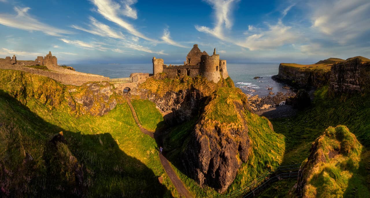
Table of Contents Add a header to begin generating the table of contents Scroll to Top The magnificent, rugged scenery of Northern Ireland’s Causeway Coastal

Visit Ballymoney

The Giants Causeway

The Giants Causeway (1)

The Giant’s Causeway

Welcome to one of the most amazing places on the planet; The Giant’s Causeway. The Giants Causeway comprises around 40,000 thousand, mostly hexagonal basalt columns descending gently into the sea. Depending on who you believe, the stones were formed either by an underwater volcano’s geological actions or by a giant named Finn McCool, who lived and battled along the north Antrim Coast.

Make your trip memorable by spending a day on a tour of The Giant’s Causeway from Ballymoney, Belfast or even Dublin. You will enjoy a comprehensive visit to Northern Ireland’s only UNESCO World Heritage site and visit nearby famous attractions. There’s no need to read about the rich history; let our tour guide provide the facts and figures while you focus on taking in its beauty.

Travel along the iconic Giant’s Causeway Coast Route in comfort, and let yourself be enchanted by the gorgeous locations on the Antrim Coast, the lush beauty of the Irish landscape, and of course, the Giant’s Causeway itself. Take away the hassle of checking maps, and stopping to ask for directions, and we will ensure you see the best spots and get plenty of time to explore the Giant’s Causeway.

History of the Giant’s Causeway

Despite the Giant’s Causeway being formed over 60 million years ago, the 40000 or so basalt columns of the Giant’s Causeway only came to be known by the broader public from around 1690 when it was “discovered” by the Bishop of Down and Conor, William King. Here you can discover more about the Giants Causeway’s history and how it became a world heritage site.

Geology Of The Giants Causeway

“When the world was moulded and fashioned out of formless chaos, this must have been the bit over—a remnant of chaos!” William Thackeray Tweet Thackeray’s

The Giant’s Causeway has some of the most amazing geological experiences on the Causeway Coast and in Northern Ireland. Visitors of this popular tourist spot have more than just the stones to view, with many natural phenomena such as the Giant’s Boot, the wishing chair and the Giant’s Organ.

The coastal walk to the stones takes in many of these offerings and the opportunity to get the obligatory selfie on the giant’s boot

Myths & Legends of the Causeway

The Giant’s Causeway, near Bushmills, has been drawing thousands of tourists from near and far with its mystery and rare geological formations; however, according to legend, the columns are the remains of a causeway built by a giant Finn McCool. The story goes that the Irish giant Fionn mac Cumhaill (Finn MacCool), from the Fenian Cycle of Gaelic mythology, was challenged by the Scottish giant Benandonner. Fionn accepted the challenge and built the causeway across the North Channel to meet the two giants. The legend of Causeway Giant’s Finn McCool and Benandonner battle is told on the big screen in the Giant’s Causeway Visitor Centre, which the National Trust runs.

THE VISITOR CENTRE

In 2012 the new architecturally designed bespoke Giant’s Causeway Visitor Centre opened, replacing the original building built in 1986 when UNESCO added the Giant’s Causeway to its coveted list of exceptional interest and universal site value.

The new centre is the gateway to the famous Giant’s Causeway, semi-hidden in the hillside. It offers various ways to learn more about myths, legends, social history, wildlife and conservation. There are large screens for shows, a shop (selling souvenirs and local crafts), and a cafe that supplies books, pamphlets, tourist information, and multi-lingual audio guides.

The National Trust runs the Causeway Visitor Centre, so it’s free to enter with a National Trust Membership.

Find out more and see opening times here.

Getting To The Giants Causeway World Heritage Site

The Giant’s Causeway lies about 20 minutes north of Ballymoney, an hour’s drive north-west of Belfast, and three hours drive north of Dublin. We recommend you take the fabled Causeway Coast Route drive to get here. The closest towns are Bushmills, with its world-famous distillery, the holiday destination of Portrush and the County Town of Coleraine. You can get to the Causeway by Rail, Bus or Coach, each having an excellent scenic route.

Once you arrive at the car park and have been through the visitor centre, you have two options to visit the stones. You can get the bus run by the National Trust or walk.

The walk is about half a mile or a kilometre from the Visitor Centre along the coast, heading eastward, and the area is well marked with signs and information plaques.

The walk is reasonably straightforward, with a consistent slope down to the causeway level on a tarmac path, with plenty of places to stop. The walk takes you around the first headland, where you’ll get your first glimpse of the Giant’s Causeway in the distance. You will also be able to take in the stunning landscape and cliff array of ancient volcanic artefacts.

The Giant’s Causeway Coast

The coastline of County Antrim in Northern Ireland is renowned for its scenic beauty, possibly the world’s best-driving route, the Causeway Coast Route, clinging to its edge. The Giant’s Causeway, sitting at the northern end, takes centrepiece as the crown’s unique jewel, known as the 8th Wonder of the World to many here in Ireland and beyond. The famous jagged promontory of around 40,000 neatly packed columns of hexagonal volcanic basalt columns was created some 6 million years ago by a basaltic lava flow.

The Giant’s Causeway is a place where myth and science meet. Were the spectacular basalt columns formed through the rapid cooling of lava from an underwater volcano, or, as some may say, created by the legendary mythical Irish Giant Finn MacCool?

For centuries countless visitors have explored the Giant’s Causeway and marvelled at its unique rock formations. Situated on one of Worlds most spectacular coastlines, its unique rock formations have stood as a natural rampart for nearly sixty million years against the unbridled ferocity of the North Atlantic storms. The rugged symmetry of the columns never fails to intrigue and inspire our visitors. To stroll on the Giant’s Causeway is to voyage back in time.

Walks at the Giant’s Causeway

The Giant’s Causeway has several fun walks, allowing you to spend hours soaking up the mystery, mythology and geology of these ancient volcanic surroundings. 

Our favourite is the Red Trail, a 2-mile walk east from the Visitors Centre along the cliff’s top and then descending a (fairly steep) staircase carved into the cliffs, bringing you out beyond the Giant’s Causeway to the coastal path and the Blue path. You experience and fantastic bird’s eye view of the coast from here, and it is a breath-taking experience and worth the effort for the giant view alone!

Blue Trail: The Blue Trail is the main walking path from the National Trust visitor centre, past the cliffs and the Giant’s Causeway.

Yellow Trail: The Yellow Trail follows the World Heritage Site’s perimeter, starting at Runkerry Head and ending at Hamilton’s Seat. The Yellow Trail joins the Green and Red Trails in parts.

Green Trail: This trail is perfect for walking the kids along, its wheelchair and buggy-friendly. It’s also fenced off the clifftops, so little ones can roam free in plain view along this path.

Insert Walking tours here

Similar Structures Around The World

The Giant’s Causeway is not as unique as you’d think. Similar sites worldwide are home to impressive hexagonal columns like those found on the North Antrim Coast. The nearest is just across the water on a Scottish Island Called Staffa Flow, where Fingals Cave is lined with large basalt columns. You can see similar structures in Isreal, Iceland, Mexico and Russia….but obviously, none are as fantastic as The Giant’s Causeway.

Flora & Fauna

The Giant’s Causeway isn’t just home to incredible rock formations. The Giants Causeway and the Causeway Coast are a haven for sea birds such as fulmar, petrel, cormorant, shag, redshank guillemot and razorbill. Simultaneously, the weathered rock formations host several rare and unusual plants, including sea spleenwort, hare’s foot trefoil, vernal squill, sea fescue and frog orchid.